
|
The days are getting longer, the sun is getting warmer, the Lambs are stirring in the fields and the Buzzards circle on invisible thermals, these signs can only mean one thing - storm season! The Winter is slowly transitioning into Spring and already solar heating is strong enough to aid with convection. In the UK late March into April is often known as 'April Showers', this simply addresses this time of year when we often still have cold air aloft combined with increased solar heating at the surface, the result is convection and for a lucky few of us this can be our first introduction to hail showers and our first thunderstorms of the warm season.
My chaser friends and I eagerly anticipate this time every year, it's often a time of year fraught in suspense, anticipation and excitement. Will we get another active storm season like 2023?, will we get our dream structure image?, our best night time lightning images, or that sought after photogenic funnel cloud, waterspout or tornado? I absolutely love this time of year, the prospect of warmer days and T-shirt weather and the thrill of the atmospheric hunt ahead. Even though Spring is in the air it sure hasn't felt like it for those living in N. Ireland, it seems that every day for the most part has been cold or just annoyingly chilly, and to underscore this, a few days earlier we had a surprise frontal snow event which was much more potent on high ground than many expected. We even had 1.5 hours of falling wet snow in Cookstown, but as a confessed snow lover I will admit that I enjoyed the event greatly even though I didn't go chasing.
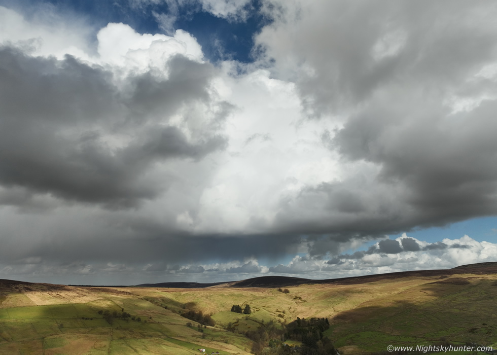
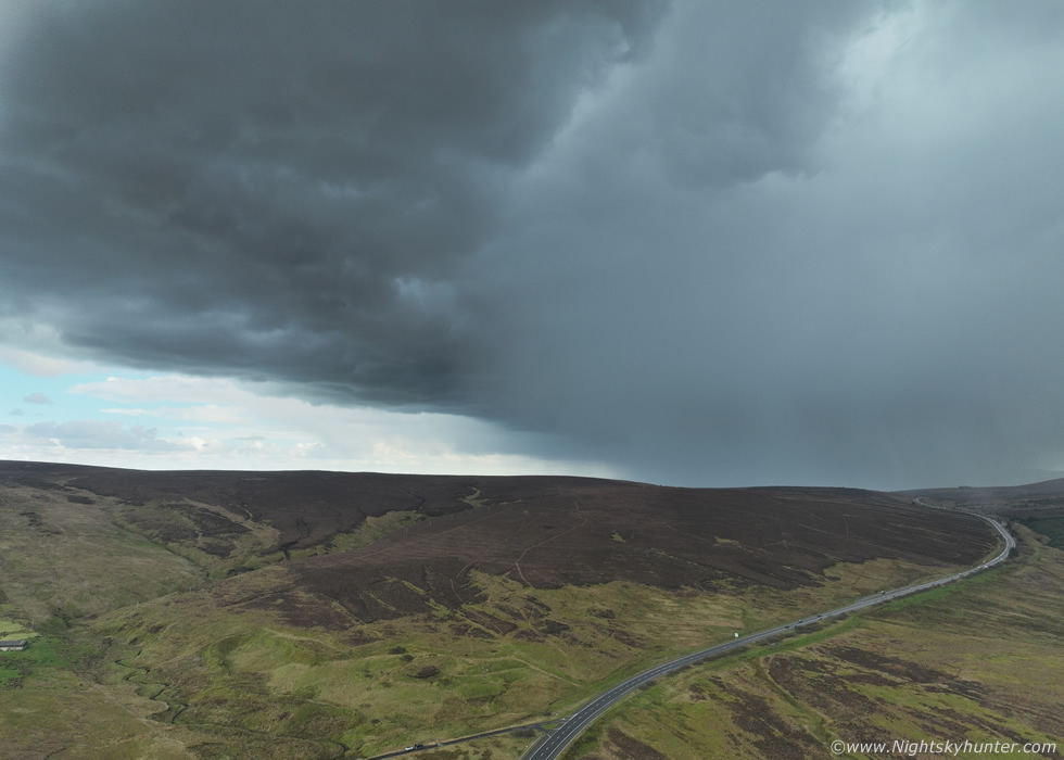
A warmer southerly flow soon began to take charge and with it came an unsettled theme with showery troughs and it wasn't long before two days manifested on the models with low end CAPE and the chance of some early season chasing which I was certainly game for. The first chase day was March 29th with 50-300 SB CAPE on a Sly flow with -40c cloud tops with zero shear. Models indicated cells would form over Co. Tyrone then the Sperrins so I went chasing. Sunny spells began to break through the cloud and the day was feeling pleasantly mild, but only 12C at best, showers began showing on radar over the target zone so Rhua and I hit the road at midday and drove S. The plan was to chase to Armagh, then follow activity back N through Dungannon this to the Sperrins. Even thought my expectations were low I was still expecting to capture at least a nice convective shower by drone, in truth this chase was just an excuse to blow off the cobwebs, get familiar with the gear and road networks again and get in the zone with the sky.
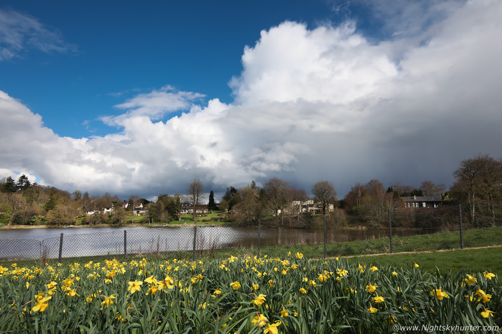 |
Convection was building over the Dungannon area and with busy roads and limited places to pull over to watch the skies I decided to take a break at Dungannon Park where Rhua and I could take a walk and consider our next option. There was a nice display of Daffodils near the pond which made for nice foreground to this growing convection.
We chased to Moy where several weak bases and gust fronts were visible however I knew at this stage that something was badly wrong with the atmosphere. The convection was small and lifeless, the tops were mushy and the bases looked soft too, then they showers would die and the residual cloud cover would spread out creating overcast conditions killing solar heating. It was a disaster, I had a lunch at a filling station, the drove back to Dungannon and watched the skies from a layby. I killed time reading one of my favourite David Levy books called 'The Quest for Comets' then took one last look at the sky. This was a complete bust, the sky was pathetic, in fact, in the top five worst convective skies I've ever seen. I will admit to being disappointed as I wanted my season to start off in a much more positive note, so at 14.00 I drove back home and the chase ended.
The following day March 30th was the next chance, the set-up was similar but from chatting with Owain Rice I learned that dry air aloft should be less of an issue with slighter better moisture too. 400SB CAPE, LI's-1, SEly flow, -40C tops, no shear, however there were hints of convergence zones and furthermore it looked like higher ground would aid with lift based on the sporadic shower distribution hinted at by the AROME. Owain Rice had uploaded a slight risk box over the W/NW of the Ulster and it was here I would be targeting cells. Rhua and I left the house at 11.00 as activity was expected to trigger sooner this day. As I drove N I had much better vibes, it was sunny all morning since sunrise with blue skies and agitated cumulus, it did look much more promising and the radio was playing 90s dance music, this had to be a good omen.
I arrived on Glenshane Pass in the Ponderosa car park where I met Nigel McFarland and later Colleen Webb, all three of us would be chasing today. It was a good buzzing meeting fellow chasers again, despite the bright glaring sun it felt chilly on high ground with a 10-15mph wind, as a result the clouds were moving fast. After much sky watching our hopes dropped again, the sky truly was awful yet again, towers small and mushy and dying out, radar was dead, we honestly thought this was going to be another bust. I consider myself well tuned into the sky with good instincts and based on what I was seeing I said to Nigel with complete certainty that there would be no storms this day, not even later for a fact, that's how sure I was (I would be wrong!). On the positive side it was great to be out under the sun getting vitamin D and having a catch up which is always time well spent.
Nigel, Colleen and I decided to go for lunch since the sky was quiet. It was great to eat and warm meal to keep the energy levels up and the talk of course all centered around photography, drones and storm chasing. We ate while simultaneously glanced out the window at the clouds while checking radar. It felt like the dinner scene at Aunt Meg's from Twister, only we didn't have any evil Bill stories to tell. We finished eating and Colleen checked radar again, now things had come to life which surprised me, there were red cores crossing the border moving up and even a few isolated red cores in our area so it was time to get back on the road. Nigel headed on to Belfast so Colleen and I re-located further along the Pass to Proctor's Corner where we could get some shelter from the wind. We literally arrived under a red core from a hail shower with hail stones bouncing off everything, that got us excited, finally something was happening.
 |
The hail shower was red on radar but visually it had an LP look about it with a fine transparent core, the shower passed over us and the sun broke out with nice light and contrast. We got the drones in the air, it felt great to finally getting shooting something, even though it was far from great it was a start and a nice feeling to finally get something in the bag for as I was determined I wasn't going home empty handed this day. We could tell from the clouds that something had changed and that maybe things would get even better, we decided we would stay to around 16.00 before the instability began to leave the area.
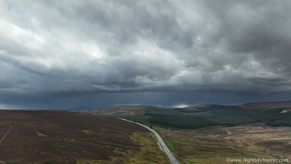 |
Radar showed that cluster of red cells still making their way N towards us, they seemed to be holding together very well, we hoped that given the lack of shear they wouldn't die out before they reached us. This looked to be our last chance of the day of getting something to shoot, the sky still looked capped so the only thing on our minds was a sunlit back edge to the showers. However, unknown to us at this time this cluster had evolved into a thunderstorm with c-gs over the W side of the Sperrins, John Fagan was hearing the thunder from Dungannon.
The cluster came into view over the hills from Glenshane, at first it didn't look impressive, but as it advanced closer we could see beefy towers on the leading E side and there was a weak and narrow shelf cloud extending across the cluster which was now bowing on radar. We got the drones in the air for a better look. At first it was a sorry sight, the mid section and W looked weaker, precip almost falling as virga, but the E side looked much more stronger and radar was confirming this was now the dominant area of the cluster.
 |
Hints of structure and getting better looking as it approached. I got the drone to 120m altitude and flew further out to the other side of the road to clear the hill and get a better view.
 |
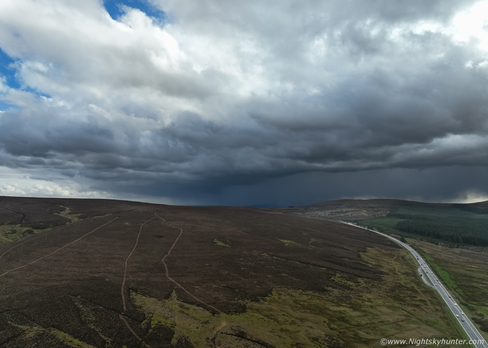
Within a few minutes this has transformed dramatically, the main core now was white on radar and topped off by an obvious curved gust front, finally structure and already more than what I expected this day. Main Glenshane Pass road leading into the cell advancing cell. Normally if you see images from this area by me they are usually showing snow, storms or gorse fires.
 |
Extremely well defined leading edge on the precip core, I was buzzing, at last mean looking storm clouds, I was content with this as a trophy from the day, at this stage anything else would be icing on the cake. I began shooting short video sequences to have for next end of year video.
 |
Both of our drones were documenting the scene unfolding, even without the cell the wind was already 15mph and increasing as the storm got closer, I knew the outflow was likely going to be strong from this one and I didn't want any rain catching the drone off guard. This scene was deceptive as its wide angle, in reality from our perspective on the ground the precip to the right looked almost rite on the drones. The bottom of Glenshane Pass and Maghera area were likely getting hammered by hail stones at this point.
 |
Massive core and still white on radar. I was getting strong wind warnings galore on the controller screen
 |
At the top of the image rain and hail was falling from a vast height in front of the Mavic 3 camera, it was time to bail. I began flying backwards towards the home point while snapping stills, you can see the rounded gust front with a subtle hint of whale's mouth. The final 300m flight back to safety was a slow process as the cell's outflow was blasting across the landscape. It was like sustained 25mph or at least it felt that way to us, the drone was tilted at a sharp angle on the last 100m and it took sports mode to get it back on time just as the core hit.
We packed the drones away then Colleen and I just stood outside getting hammered by the core, we wanted the full experience. We got buffeted by cold outflow wind combined with a deluge of well developed hailstones. The stones were the size of frozen peas and blowing hard in the wind, we felt like kids in awe as hailstones bounced off the ground around us and off the cars, it was great fun. It actually hurt when we got hit in the face, at one stage I swallowed a hail stone, I joked saying it was a good omen to eat them. Behind us was a clearance with blue skies and under the low anvil we got see mammatus pouches hanging across the sky.
We were having a great time, a gust front, hail stones, mammatus, we both said out loud while hail battered us that the only thing missing was thunder. No sooner had the words left our mouths when two loud rumbles of thunder boomed from the hail core close by to our NE. We yelled with delight and joy, we couldn't believe it, we had thunder! we had just experienced our first inland thunderstorm of Spring. We were on such a natural high, trust me when you are into storms there's no better feeling than getting your first thunderstorm early in the season to set the scene for the months ahead, there really is nothing else like it. Meanwhile the temperature had dropped like a stone, it went from Spring to Winter in an instant, our faces and hands were red with the cold, it was like we had been throwing snow balls for half an hour.
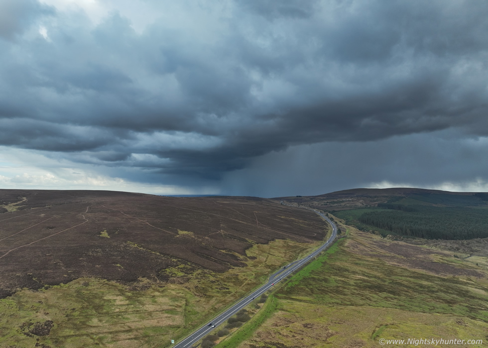
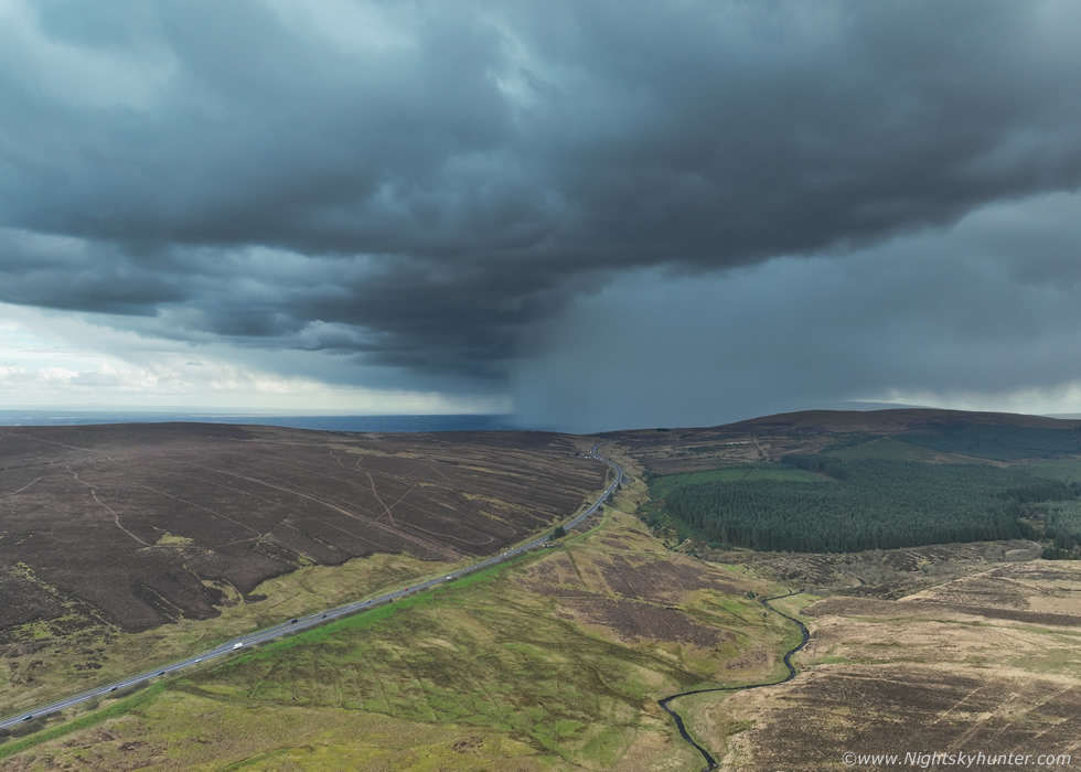
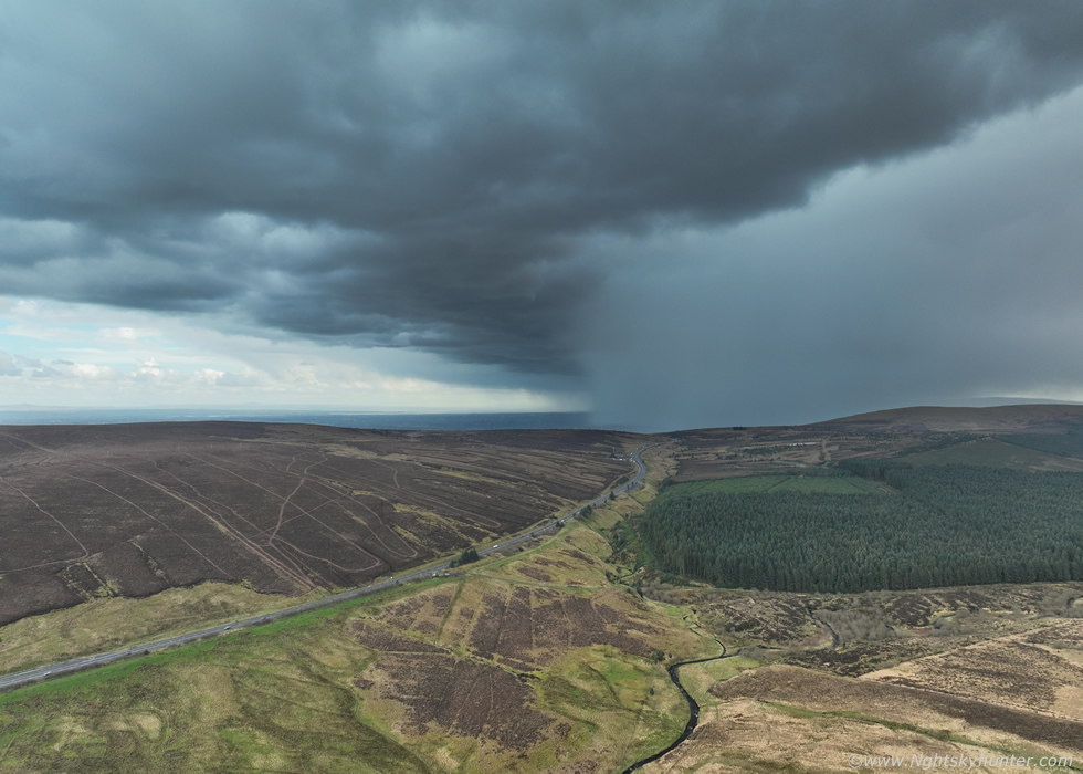
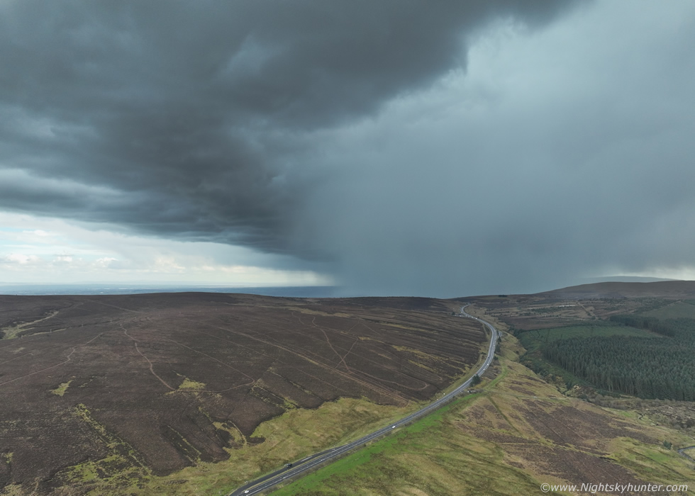
After this we just relaxed and talked about the storm, as far as we were concerned that was the catch of the day, the CAPE was leaving so time to head home. Colleen spotted more cores on radar moving north along the Sperrins, we figured they would likely die out but we were on such a lucky streak we decided to make one last play on them. We left Glenshane then pulled over at the Moyola River and checked radar again, that next cluster was coming up the Sperrins in the far side of Slieve Gallion, we made one last effort and drove through Tobermore, Draperstown and pulled in at Lough Fea.
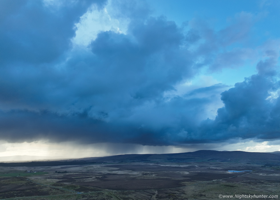 |
To our west moving N along the Sperrins was that line of cells, they had that deep thundery blue look to them. Nigel rang from Toome, he could see the tower on the leading edge of the cluster we where chasing, he said it looked substantial. Minutes later we heard three rumbles of thunder from the lead cell, we never saw the lightning and suspected the discharge was in-cloud and high up within the tower, this is a drone capture from this moment. This was the icing on the cake, two storms encountered on the same day and five rumbles of thunder between the two. The season now is truly underway with bigger and better storms to come.
I filmed a vlog covering the last two chases documenting the bust chase and our success on Glenshane Pass including drone footage of the storm and its hail core. It's a little rusty around the edges as I haven't made a vlog in some time but I wanted to share it anyway to document this good memory. Thanks very much for reading.
Martin McKenna
